
To gain a thorough understanding of bore logs and their types, delve into the section on ‘Types of Bore Logs’ with a focus on ‘Soil Bore Logs’, ‘Rock Bore Logs’, and ‘Groundwater Bore Logs’. Each sub-section has unique solutions tailor-made for your specific needs and terrain.
Soil Bore Logs
Soil Exploration Reports
In geological studies, soil exploration reports provide information regarding the subsurface terrain. It entails examining soil and rock samples obtained by drilling boreholes. Below is valuable information on various types of soil bore logs.
| Type of Logs | Purpose |
|---|---|
| Depth to Bedrock | Depth at which bedrock occurs |
| Soil Classification | Soil type identification according to grain sizes |
| Rock Type | Lithology or classification based on its mineral content |
| Water Table | Depth to groundwater levels |
| Soil Sampling | Determines properties like moisture content, density, and strength. |
Choosing the correct type of bore log depends on the research needs, site grade classification, and geotechnical issues in a particular site.
Rock Bore Logs
Rock bore logs are geological records of rock formations obtained through drilling. A table for rock bore logs includes columns such as depth, lithology, colour, texture, fracture, and mineralogy. Depth represents the distance drilled from the surface to the current location. Lithology refers to the type of rock encountered throughout the drilling process. The colour indicates the hue observed in exposed surfaces of rocks, while texture signifies the size and distribution of grain or crystal components. Fracture denotes cracks or planes within rocks that result from various strain forces applied over time. Mineralogy identifies multiple minerals present in a specific formation.
Rock bore logs can also include structural data on which geologists identify any deformation acting upon rocks. In addition to this, they record any indications of groundwater zone occurrence and quality assessments.
The importance of rock bore logs must be considered since it helps understand subsurface geology accurately for efficient exploitation and management purposes.
Groundwater Bore Logs
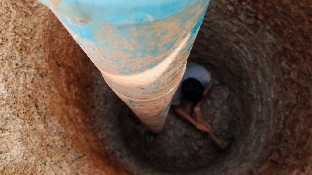
Mapping groundwater resources is crucial for water supply and management. Groundwater bore logs assist geologists in identifying groundwater levels, aquifer depths and water quality. Boreholes are drilled to explore underground water sources for domestic, industrial and agricultural purposes.
In addition, bore logs provide crucial information such as pumping rate, wellhead elevation, geology types, well construction details and other ground characteristics that can affect water yield.
Overall, bore logs help identify groundwater resources and their characteristics. Providing reliable data on aquifer depth and water quality enables effective decision-making regarding water resource development and management.
What Information is Collected in a Bore Log
Bore logs provide comprehensive information about the soil and rock layers below the ground. This information includes geotechnical data, water table depth, groundwater quality, and type of materials encountered.
What Information is Collected in a Bore Log:
| Data | Description |
|---|---|
| Boring Depth | Depth from the ground surface to where drilling is stopped |
| Soil Type | Classification based on characteristics like texture |
| Rock Type | Classification of rocks based on physical properties |
| Water Table | Depth at which groundwater is found |
In addition to these data points, bore logs provide details about any problems encountered during drilling, such as obstructions or unstable ground conditions.
Furthermore, keeping notes about the equipment used and the personnel who oversaw drilling is crucial. Accurate record-keeping can assist with project planning and decision-making processes for future projects.
Suggestions for maintaining thorough bore log records include taking precise measurements during drilling and regularly checking equipment for accuracy. Developing a standardized procedure for logging will help ensure consistency across projects.
Capture live data from all major data logger manufacturers.
How a Bore Log is Used in Engineering and Construction
The application of bore log reports in engineering and construction projects is significant. A borehole log can provide information on soil type, depth and moisture content in a project area that is essential for foundational design.
A table showing the data extracted from a single borehole log results in several columns. These may include the borehole ID, depth intervals, soil type, rock strength, groundwater level and the associated lithology. The gathered data aids engineers in making informed decisions regarding foundation designs.
Borehole logging uncovers unique details about an area’s geological formation, which are not visible to the eye. Such fractures within rocks, underground streams, or unexpected soil composition could cause problems during construction.
It is suggested that geologists and hydrologists should perform regular tests to ensure accurate and updated bore logs are created. It is also worthwhile spending time with experienced contractors who have worked on similar sites before for a better understanding of successful strategies used in the past through their expertise.
The Bore Log Process
To understand the bore log process with its sub-sections on planning and preparation, drilling and sampling, and logging and reporting. These steps are critical in determining the subsurface formations encountered during drilling operations. Engineers cannot design safe and economical wells without a comprehensive understanding of the geologic formations.
Planning and Preparation
Before conducting bore logging, there are several crucial steps that must be considered to ensure the successful collection of geological data. This involves strategic planning and preparation where various aspects, including the location of the borehole and equipment, are assessed. It’s recommended to involve geoscientists and engineers in this process.
The initial planning phase starts with identifying suitable drilling locations based on geological data and any preliminary site investigations conducted. The depth and thickness of the subsurface rock layers will also influence the choice of drilling sites and factors like safety, access, drainage, and proximity to any infrastructure.
Once a drilling location has been selected, selecting appropriate equipment for boring operations, such as an auger or rotary drill, is necessary. Site preparation may include clearing vegetation, creating an access road, securing permits from regulatory bodies and ensuring adequate water supply is available for drilling purposes.
To avoid complications during drilling, contingency plans should always be established in case of unforeseen circumstances like groundwater inflows or equipment failure. Geo-scientists determine optimal core recovery rates that minimize costs while maximizing data output and providing expertise in analyzing the collected samples.
Drilling and Sampling
Drilling and sampling refer to the critical initial stage of data collection. It involves extracting geological information from below the surface by using specialized tools.
The following table presents essential information on drilling and sampling techniques used in bore logs:
| Technique | Description |
|---|---|
| Auger drilling | Used for shallow soil sampling with hand-operated equipment. |
| Rotary drilling | Accomplished using a rotary bit that drills through various rock formations. |
| Sonic drilling | A high-frequency vibration tool used in difficult geology areas creates undisturbed geological samples. |
| Diamond core drilling | Uses a diamond-tipped bit to extract cylindrical core samples of rock strata or mineral deposits. |
Moreover, other considerations for obtaining representative stratigraphic data include the depth and diameter of boreholes, frequency and completeness of sampling, and clear identification of lithologic units.
According to scientific reports, drilling at predetermined locations offers the most cost-effective solution for gathering accurate data while conforming to regulations.
Logging and Reporting
The Process of Capturing and Communicating Data
Logging and reporting are fundamental in capturing and communicating data obtained from drilling boreholes. It is crucial for accurately characterizing the subsurface geology and groundwater flow and performing environmental assessments.
- Logging and Reporting involve recording the geological characteristics of rock cores or drill cuttings.
- The logs typically include water level measurements, water quality analyses, and pumping test results.
- Subsurface conditions are analyzed and interpreted by a qualified geologist or hydrogeologist to provide information on groundwater recharge/discharge patterns, contamination levels, and the protectiveness of geologic barriers.
- The data gathered during logging and reporting can assist in well design optimization to improve yield rates or avoid zones with high levels of entrainment.
- The reports generated are used to comply with regulatory requirements to ensure compliance with environmental regulations.
It is essential that the logging be performed by experienced personnel capable of providing reliable interpretations. Proper QA/QC procedures must always be followed to minimize errors.
Effective communication between those involved in the logging process is critical for accurately representing subsurface conditions. Certain codes are used for instrumentation types, and characteristic colouring schemes allow for easy visualization of logged data.
For optimal results, it is recommended that industry best practices for data transfer, storage, and analysis be utilized consistently. This includes secure electronic data transfer mechanisms through trusted channels combined with secure backup protocols to prevent data loss that could lead to avoidable costs down the line.
Reading bore logs is like deciphering hieroglyphics, but instead of ancient secrets, you just find out how deep the dirt is.
Interpreting Bore Logs
To interpret bore logs with an understanding of soil and rock properties and identify hazards and contamination, you need to analyze the geotechnical information recorded during the drilling process. In this section, we will guide you through the process of interpreting bore log data, highlighting two critical sub-sections – understanding soil and rock properties and identifying hazards and contamination.
Understanding Soil and Rock Properties
Soil and rock properties are crucial in construction projects. Understanding these properties helps engineers make informed decisions about building design, soil stabilization, and foundation support. With the help of bore logs and other geotechnical data, a trained professional can assess the geology of a site and determine subsurface conditions.
Bore logs document various aspects of soil and rock properties, including composition, density, and fracture patterns. These logs are created by drilling boreholes into the ground and extracting samples at different depths for analysis. Engineers rely on these logs to determine what type of foundation best suits the area’s soil conditions.
Furthermore, interpreting bore logs should be done cautiously as there is always room for misinterpretation if not handled expertly. One suggestion for ensuring accurate interpretation is obtaining additional data before reaching conclusions from initial findings. Another helpful tip is seeking out expert second opinions when appropriate since multiple perspectives provide more trustworthy assessments.
Identifying hazards and contamination, because nothing says ‘fun’ like getting sick from drilling in toxic waste.
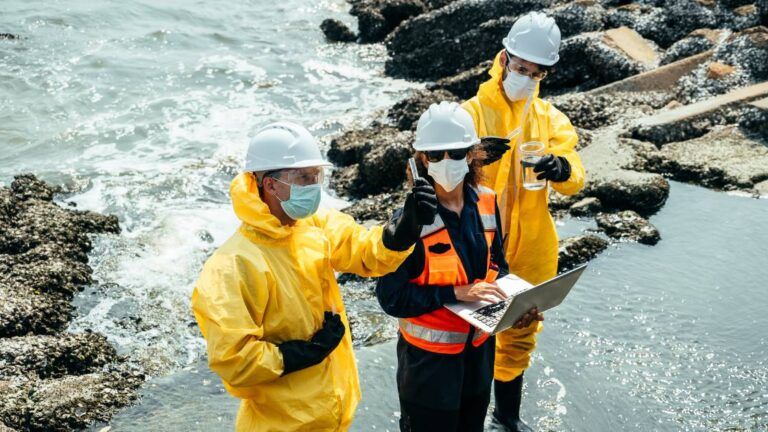
Identifying Hazards and Contamination
Hazards and Contamination are significant considerations while interpreting bore logs. It is crucial to identify any potential threats posed by hazardous materials that may be present in the subsurface, such as petrol, diesel, chemicals, or waste. This identification enables environmental managers to make informed decisions concerning excavation processes, site rehabilitation and the safest ways of handling extracted substances.
Here’s a 5-Step Guide for Identifying Hazards and Contamination:
- Review Report: Check previous site investigations or due diligence surveys, if available, to establish past uses of the site.
- Visual Inspection: Look out for discolouration, consistency, presence of sheen on water samples and foreign objects during drilling.
- Laboratory sampling: Take borehole samples to the laboratory for analysis to determine contamination levels accurately.
- Geophysical Testing: Use geophysical techniques such as GPR (Ground Penetrating Radar) or EMI (Electromagnetic Induction), which enable the detection of metallic and non-metallic objects.
- Risk Assessment: After data collection from the above-mentioned steps, estimate the dangers and prospects’ cause-effect impact on human health, safety, and the environment.
It is essential to interpret results, ensuring accuracy by utilizing credible scientists’ expertise. Several factors may hinder interpretation success – including varying geological formations affecting formation logging tools differently.
A groundwater crisis in Flint, Michigan, USA, where lead-contaminated drinking water caused national outrage, is one excellent example that advocates for proper bore log interpretation in identifying contamination hazards repeatedly ignored by authorities.
Without boring you with the details, bore logs are a crucial tool in engineering and construction projects.


[…] Types of Bore Logs […]